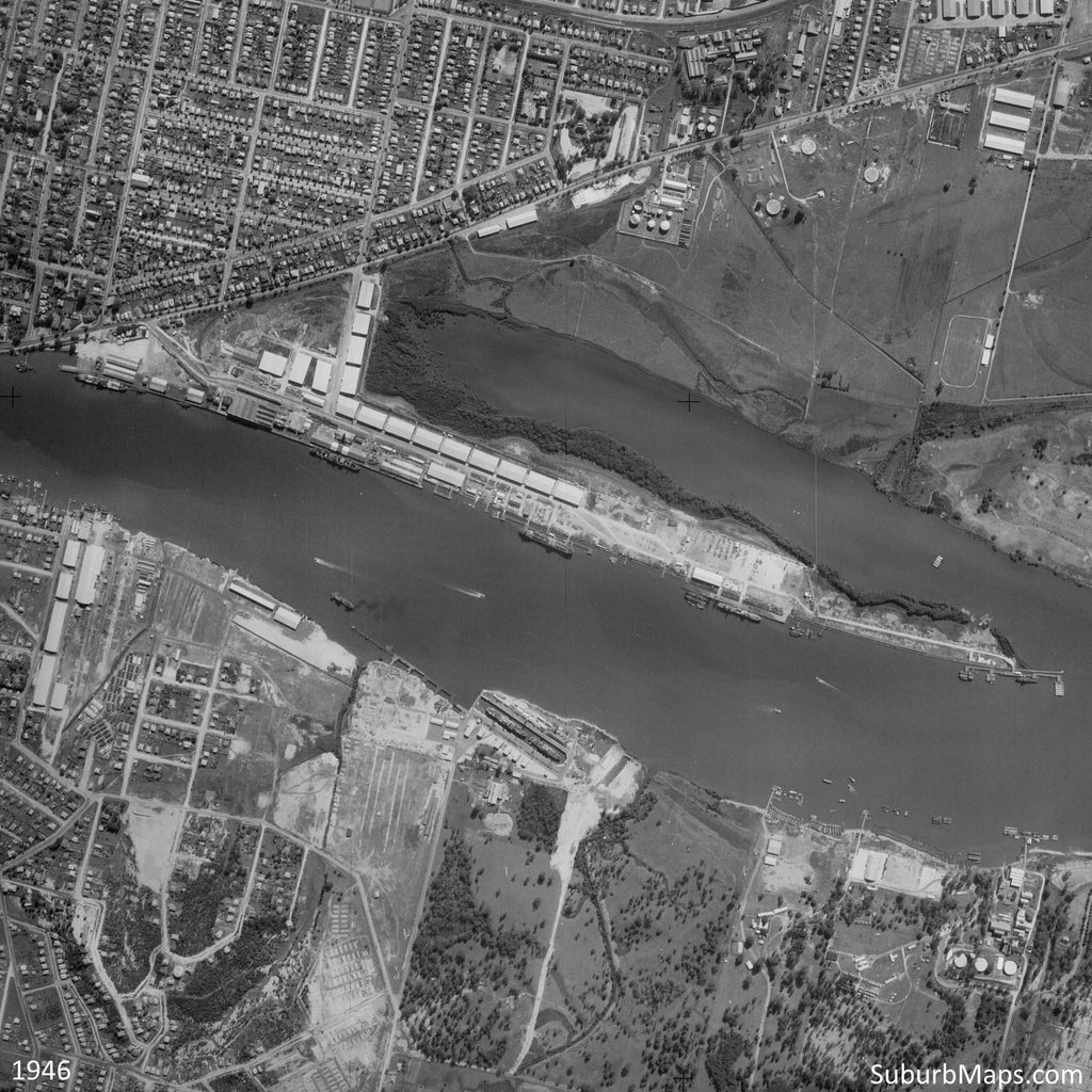
ANZAC Day - 1946 Aerial Photo - Hamilton and Bulimba
In memory of those who have served our Country
LEST WE FORGET.
This ANZAC day we are thinking about those who served our country. We have done some research to highlight some of the evidence in aerial photos of the war effort in Brisbane.
Our ANZAC Series
- 1946 Victoria Park
- 1946 Greenslopes, Holland Park and Ekibin Hospitals
- 1946 Hamilton RAAF Flying Boat Base / Camp Bulimba
- 1946 Archerfield Aerodrome
- 1946 Mains Road / Kessels Road MacGregor
- 1946 Darra / Richlands
This aerial photo of 1946 Brisbane, Hamilton, Bulimba and Morningside shows the bases surrounding the river used in World War II.
Hamilton RAAF Flying Boat Base
RAAF Flying Boat Base Hamilton contained a jetty and huts, although additional mooring buoys were also laid at Colmslie and Gibson Island. For a time after mid-1942 convoys were provided escorts by Brisbane-based Catalina’s operating from Hamilton. Crews of the Catalina flying boats were housed in leased premises known as 'Catalina House' in Langside Rd, Hamilton when they flew into Brisbane. The Base was controlled by No 5 Transport and Movements Office. No 41 Squadron RAAF in particular regularly flew into and out of Brisbane.
Although the RAAF flying boats continued to be used after the war to repatriate prisoners-of-war from the Pacific, RAAF Hamilton was surplus to requirements by early 1946 and was de-commissioned.
(Queensland Government – Queensland WWII Historic Places)
More information available: Hamilton RAAF Flying Boat Base
Camp Bulimba - Apollo Barge Assembly Depot
The US Army Transportation Service was allocated the former Apollo Candle Works site at Bulimba for the establishment of a supply depot which included warehouses and assembly of small boats and barges. Later known as the US Engineer Boat Yard at Bulimba Point, it received prefabricated barges from the USA for local assembly.
(Queensland Government – Queensland WWII Historic Places)
More information available: Camp Bulimba
Compare the 1946 Aerial Photo with present day Google Maps


Brilliant Then/Now Comparison. Engineering and Economic Marvels over the last 75 years. It would be very interesting to go back another 75 years (1871) to see what what it looked like in early colony and aboriginal times.
Thanks.
Leave a comment