1931 View from Francis Lookout, Corinda
Panoramic view from Francis Lookout, Corinda,
across the Brisbane River towards Mt. Coot-tha, 1931

(SLQ Image - Photographer: Ernest Harold Mears)
This is the view from the same location today overlooking Francis Lookout!
Francis Lookout in Google Maps

1936 Corinda - Aerial Photo
The yellow arrow shows the location and direction of the photo.
This part of Corinda is just on the border of the Sherwood Junction Estate Map.
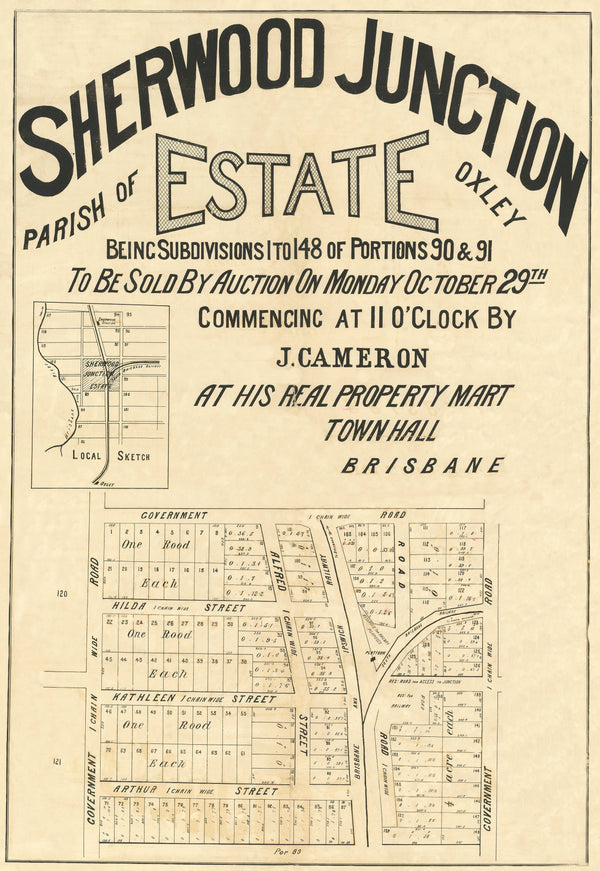
1883 Sherwood Junction Estate.

1936 Corinda Junction Aerial Photo.
(Images sourced and adapted from State Library of Queensland, State of Queensland and Google Maps)
Leave a comment